The End of the Road

After 14 months of wanderings, it’s time to finish the journey. This is the missing, long overdue report from the last part of our trip.

In June, I wrote about Portland and naked people riding their bikes to work. That was a bit awkward… I’m used to naked people, even on bikes, but work…? Come on! We were on a Sabbatical! Who needs work!

Well, apparently we do. Our travel budget, the Sabbatical fund I wrote about last December, started to dry out quickly. Now, I’m back to work and the daily routine. I’m not dreading it like I used to. Even if it’s really not as fun as visiting National Parks and sleeping with the bison, the job provides for our daily needs and… builds the next Sabbatical fund. But before we go to far out into the future, let me finish this one first.

While in Portland, we actually stayed in a neighboring Vancouver, which is just across the river in the state of Washington. We lived for a few days with a Polish couple (“friends of our friends”) and also with people we’ve met in Bend, OR. During that time we had a chance not only to visit Portland, but also to take a tour of Columbia River attractions. What we didn’t do, is to say good bye to the Ocean. Realizing that the weather in the valley between the Coastal Range and the Cascades is rather unpredictable, we decided to skip Seattle and the other Vancouver and start heading East, towards home.

Our first stop was just mere few hours from Portland, where our new friends took us to teach us wind surfing. After all, we were in The Dalles, near Hood River, the World’s capital of windsurfing! We all tried the sport with… various degrees of success. I have to admit, Nadia was probably the best student and was able to surf within minutes. Alex wasn’t far behind, so was Agnieszka. I, on the other hand, am rather slow learner and my body’s flexibility resembles that of a log. Most my attempts to stand up straight ended up in uncontrolled falls. The sailing is relatively easy, standing on a small board in the middle of a mighty river is the difficult part…

After passing Mount Hood, we entered the high desert again and the weather improved significantly. Following the Oregon Trail, with a short stop near Ontario, small town on the border with Idaho, we reached Boise. We lived there for a few days with yet another friends from Poland and during that stay finally had a chance to see what the Famous Potatoes state is all about. We were not disappointed – Idaho, maybe not as famous as Utah or Colorado, can easily contend with them for the title of Americas capital of outdoors. Sitting on the Snake River Plains, with the breathtaking backdrop of the Rocky Mountains, Boise is one terrific town to live!

We spent a few days in Idaho Falls. It’s a small little town near Wyoming state border. Our next stop was suppose to be Yellowstone National Park, and we needed to refill our food supplies and gear. As we’ve learned before, anything and everything in the parks is twice as expensive.

To get from Idaho to Yellowstone National Park, we had to go through Montana. The park is located primarily in the North-West corner of Wyoming and there are four entrances leading in, two of them are in the state of Big Sky. The park, widely known for it’s natural beauty and abundant wildlife is enormous in size. It spans an area of almost 3,500 square miles (9,000 km2), comprising lakes, canyons, rivers and mountain ranges. We lived there for almost a week, covered over 300 miles, almost never crossing the same path twice and still left the park with a feeling of deficiency. We could easily spend another month in the park and still be awed by it’s beauty.

Our base camp was at the shores of Yellowstone Lake, which is one of the largest high-altitude lakes in North America. It is centered over the Yellowstone Caldera, the largest active volcano on the continent. It has erupted with tremendous force several times in the last two million years. Fortunately we have been spared the spectacle… but one can tell that something’s going on under our feet. The entire park is full of geothermal features, Old Faithful being probably the most renown, but definitely not the only one. Apparently half of the world’s geothermal features are in Yellowstone! Everywhere we went, we stumbled upon geysers, hot springs, mud pots and fumaroles.

We’ve learned that Yellowstone is the the largest remaining ecosystem in the Earth’s northern hemisphere. It is the largest remaining continuous stretch of mostly undeveloped pristine land in the continental United States. With the successful wolf reintroduction program, which began in the 1990s, virtually all the original faunal species known to inhabit the region when white explorers first entered the area can still be found there. Most tourists visiting the park create traffic jams taking pictures of bison, elk and deer from the comfort of their car seats. Some embark on the journey on the many hiking trails available, and are rewarded with close up encounters with the fauna in the unspoiled surroundings. We happened to setup our tent next to a bison’s favorite scratching tree. Falling asleep 20 feet away from the buffalo, we listened to snores of that 2,000 pounds piles of beef, telling ourselves that those animals are nothing more than just furry, oversized cows…

The next stop on our journey was just a mere couple of hours away. South of Yellowstone, almost adjacent to the park, lies another marvel of American tourist industry – the Grand Teton National Park. The park takes it’s name from the massive mountain range shooting up from the plains. It’s biggest peak, also bearing the same name is 13,770 ft (4,197 m) tall and overlooks a beautiful valley down below, where we stayed for a few days. We spent our time discovering park’s rich history and geography, hiking, playing in the many lakes, boating and just relaxing. In our records, Grand Teton is one of the places why we embarked on this journey in the first place.

We have left Grand Teton on the eve of Independence Day. We started late afternoon and decided that this will be our first teleportation experience. The kids felt asleep in their comfy seats around 9.30 PM, Agnieszka followed within minutes. When they woke up in the early morning, the car was park in front of… Bryce Canyon National Park waiting for the gate to open. As promised before, we were back in Utah! Overnight, the tall peaks of the Rocky Mountain ranges gave way to hoodoos and the moon-like landscapes of the canyons. Juicy greens of the fertile northern ecosystems turned brown. The air was filled with dirt that hasn’t seen rain in months.

Few nights in the park gave us an opportunity to discover not only the marvelous views from the top of the canyon, but also to explore below the it’s edge. On our treks we stumbled across many weird and mysterious looking rock formations, many of them resembling in shape faces, people or animals. Very spiritual place indeed…

We continued our passage through southern Utah in the daylight. From Bryce we took course for the Arches on the state’s back roads. On the way there, we stopped for a short visit in Capitol Reef National Park. We didn’t plan a longer stay, just enough time to collect the Junior Ranger badges… After all, who wants to stare at yet another Lime or Navajo Sandstone formations, right?

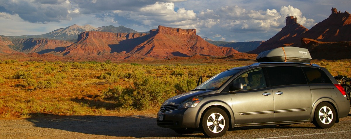
The next few days we spent at an RV park in Moab, Utah. This small town is surrounded by the most unusual rock formations making this part of the continent an ideal set for low budget sci-fi movies. What’s more interesting though, is the fact that both, Arches and Canyonlands National Parks are just a stone throw away from the town center.

We left Moab in the afternoon and once again, applying our newly acquired teleportation technique, the crew woke up on the shore of a little mountain lake  in… Granby, Colorado. It was time for breakfast.

The southern entrance to Rocky Mountain National Park is just a few miles north from town. The steep road quickly climbs  from the bottom of the valley, all the way up to the 14,000 feet (3,700 m) tall peaks above it. We have spend the entire day driving through the mountains, inhaling high altitude air and admiring the breathtaking views… or as much as we could see through the thick of clouds.

Once on the other side of the Rockies, we headed back North. We ended our little detour and got back on the all familiar I-90 in South Dakota. While there, we decided to visit Wind Cave National Park,  Mount Rushmore and Badlands. In fact, the Black Hills are full of tourist attractions and if we were to see them all, we would need an entire month… and much deeper pockets, too. A little tired with all the fancy sites, we decided to skip the Crazy Horse Memorial (the largest sculpture in the world),  Jewel Cave National MonumentHarney Peak (the highest point east of the Rockies), Mammoth Site in Hot Springs (the world’s largest mammoth research facility), historic Deadwood and even the Sturgis Motorcycle Rally (that’s because I sold the bike and the rally wasn’t until August anyway).

Out of the Badlands and onto the I-90, we spent the next couple of days observing endless fields of corn. Once on the other side of the Great Plains, we visited our good friends, who live in small town on the west outskirts of the greater Chicago metropolitan area. We haven’t seen each other in several years and the acquaintance goes back to our teenage years. No wonder we needed over a week to catch up.

We left Chicago and headed almost straight home. One stop in Sandusky, and we felt like home again. This little town sitting in the middle of the Rust Belt resembles many of the towns we got used to see in upstate New York.

At the end of July, after 14 months of wanderings, we got back to New York. The tenants were getting ready to leave, but not quite out the door yet. We stayed a few days in Stony Brook State Park, just minutes from our house. Since there were high winds going over the area, one night we even got to visit our neighbor…

To finish the journey, we met with friends, who year earlier came for a farewell party in Buckaloons, this time we welcomed them in Watkins Glen. After traveling throughout most parts of the continent, we came to a conclusion, that there isn’t a region in the US more beautiful than upstate New York, and particularly the Finger Lakes are the most spectacular of all.

Aren’t we lucky to live in the heart of it…!?! The End.

Portlandia, where people ride naked

Portland is one of those cities that you either love or hate. We visited downtown for only a few hours, but we got the essence of it: naked bike riders, gay pride festivals, homeless people dancing in the streets, etc…

We visited Portland for just one afternoon, but like with the visit to Yosemite, we were lucky enough to see just the exact things that make this place World famous…

We stayed with  Małgosia’s old friends, who live in Vancouver, WA. Warned that the city tend to be crowded and parking lots expensive, we left the car at the Columbia river banks and took a train downtown. Nadia and Alex loved that ride!

After a quick lunch in Chinatown, we stumbled upon a Saturday market area, which spreads along the river. Even though we’ve expected fruits and vegetables, we only found lots of tourists, arts and crafts vendors, homeless people taking baths in the fountains, gay couples, transvestites, naked people riding bicycles, fathers with their babies petitioning to legalize cannabis, etc… The usual stuff you come to expect to see on this side of the Rockies.

Later, while staying with another friends, we’ve learned about Portlandia, a TV series portraying this interesting city in just so slightly distorted mirror.

All in all, we liked the city full of gay people and transvestites dancing in the streets and homeless people giving free hugs, smiles and kisses…

Memorial Day Weekend

Unlike normal people, we hate weekend. And Memorial Day is probably the worst of them…

I wrote my last report sitting at a Starbucks in Fresno. I was sipping coffee, watching people and waited for the car repair bill. What I didn’t cover was the reason why I got 20 minutes late to the service garage. At the time we were staying at the Millerton Lake near Fresno and I had an appointment at the service garage at 7.30 in the morning. Since it’s a 30 minutes drive, I left 10 to 7.00 AM, just in case… Good thing I did!

If I left only 2 minutes earlier, I would have definietly make it on time to the mechanic, but I would miss quite a spectacle. Obviously from time to time, every one of us meets a cow or two in the middle of the road. But what about 300 cows led by and  followed by 5 cowboys and their smart collie…? The cattle were being driven from one pasture to the next, few miles dwon the road. A truly wild west experience…

From Fresno, we headed back to the cold Sierra, this time to visit Yosemite. As Agnieszka already reported, we didn’t stay there long, mainly because of the crowds of people, in their large SUV’s and enormous RV’s, with their expensive cameras, filling up the valley all week long. We managed to find one camping spot, 25 miles north from the most scenic rocks and waterfalls, far from other people. Yes, we were lucky to spot a bear and a mountain lion, both within 6 minutes, half mile from one another,  but we failed to find another camping spot for the upcoming weekend. Gosh, I hate weekends!

We spent the next two days in Turlock Lake, a small park near Modesto. As all California state parks, this one was a no frills, expensive ($30/night) and in dire need of upgrades. Unlike others, this one was also infested by blood thirsty mosquitos, beer thirsty rednecks and fiestive Mexicans. We managed to survive the dreaded weeekend and Sunday afternoon moved to another park near Valley Springs. This one is being administer by the US Army Corps of Engineers and despite surface similarities is indeed much different. At only $16 per night it’s not only significantly less expensive, but also has clean, modern facilities and overall seems to be much better managed. Although Valley Springs is just a small town and offers no tourist attractions, we welcomed the change and decided to stay for the whole week. That gave us an opportunity to catch up on the homeschooling program, visit local libraries and just hang out on the lake. On Friday, when the “weekenders” started to arrive, we packed our van, left the quitet refuge and headed for the city…

Sacramento, California’s capital is not as big as some of the better known cities on the west coast. It retains it’s small town atmosphere, while providing all the services and attaractions of a much larger metropoly. We stayed there for almost a week. On the weekend, we visited our old friends, who moved here from Hornell 6 years ago. They live in downtown, which gave us a chance to see the heart of the city first hand. We went to a concert, to a zoo and to museum of rail transportation, enjoyed a pacific rim fair and walked the streets of a western-like historic district. Of course we also spent countless hours talking about the “good old times” while drying out a few bottles of wine. On Sunday, we moved to the outskirts and stayed with a wonderful couple we met few weeks earlier at Zion and in the Death Valley. Patti and Del not only hosted us for four days, sharing their travel and family stories, but also took us cayaking and showed us Folsom and Orangevale on the bikes. Nadia and Alex loved the pool, we couldn’t get enough of Del’s barbecued ribs. But on Thursday it was time move on…

Last weekend was Memorial Day, which means… we’re screwed. Instead of San Francisco, we landed in Sonoma valley on a campground far from the bay area. But it turned out to be great. We have spent four days hiking, visiting local library and… wine tasting. After all this is the Sonoma Valley!

Grand Canyon to Fresno

From Grand Canyon to Fresno, California. We are on the move, but hoping to be able to stop somewhere for at least a week. By now, setting up and folding down the camp is our second nature….

It’s early Wednesday morning in Fresno. I’m sitting outdoors at a Starbucks Coffee table, watching people drive by, talking on their cell phones, texting, listening to the silly morning shows and the ever scarier news. They’re grabbing their bucket-sized coffee mugs without even getting off their cars – efficiency, I guess… I’m sitting alone, sipping my coffee and munching on an overpriced piece of preprocessed carbs (leaning the lingo from the hyper-wife). The place is busy, most young people getting in and out in a hurry, some retirees lingering indoors for hours – talking, reading newspapers or just sitting quietly, enjoying the drink.

It’s only 8.00 AM and the temperature is already in the upper 80’s. I move inside, looking for the air-conditioned breeze. Soft jazz tunes flowing from the hidden speakers are topping up the cacophony of noises: steaming coffee machines, people’s chatter, baristas calling orders, doors opening and closing, chairs scratching the floor… Slowly, I work my way up to the comfy armchair in the corner. It takes persistence and time, but just like the retirees, I have plenty of it. The car is left at a local repair shop and I rode the bike to this chain, characterless coffee shop to write this little update.

The brakes needed tune-up to bust my confidence level. Couple of days ago, we came down from the Sequoia and Kings Canyon National Parks in Sierra Nevada. Fortunately we entered the magical, giant forest from the south, which means we had to climb the steep, curvy roads in a 7,000 feet ascend. Getting down to Fresno, the road was of a much lesser incline with only a few winding bends. Next stops are going to be Yosemite and Lake Tahoe before visiting Sacramento. Good brakes will be essential, while traversing the Sierra back and forth.

The barista yells another order: Grande Iced Skinny Caramel Orange Mango Machiato! What, the heck is that? All I understand in “grande”, which in the Starbucks units of measurement is a medium size. Still, that’s 16 oz of liquid… Anyway, it reminds me that I’ve written the last trek update in Grand Canyon and in the meantime, we’ve moved a few states to the “left”.

In the Grand Canyon we had an opportunity to see elks, mule deers and plenty of other wild- (and yet surprisingly domesticated) life passing through our campsite. That of course to top the wonderful views down the world’s most famous hole in the ground. We even found the strength and courage to hike down the canyon. Not to it’s very bottom, just to the Cedar Ridge, but we joined the club of only 5% of visitors, who dare to set foot below the rim densely spotted with shops, lodges and restaurants.

The weather was very cooperative with chill nights and pleasant, sunny days. Considering that just a week before, there’s been snow on the ground, I think we got very lucky. Unfortunately, our luck left us upon leaving the park. Headed to the Zion National Park, we decided to stay for the night near Page, Arizona at the Colorado river dam at the southern end  of the Glenn Canyon. The place in known for it’s uncommon views that attracted lots of science fiction movie makers looking for the Moon or Mars-like views. It also draws a lot of photographers, who seek the perfect light down at the Antelope, one of the few slot canyons around here. When we set up the tent, the wind started blowing, black clouds rolling in from the west. The weather forecast for the next day called for rain, a lot of rain… As one of the fellow campers put it, we were lucky to experience such weather in this otherwise very hot and dry place. Well, I guess everything depends on your point of view…

We decided to fold our camp before it gets wet and headed west. Passing the campground gate I turned the windshield wipers on. The timing couldn’t be better… For the next few hours we drove in heavy downpour. Our moods were gloomy, but the car got washed off of the dirt it accumulated on the different deserts.

Approaching Zion, the sun started to peek out from behind the clouds, when we entered the park, it cleared off almost completely, giving us truly unspoiled views of the most unusual and colorful rock formations we have ever seen. Dominated by reds and deep browns, the park is a mecca for all sorts of outdoors enthusiasts. Even though there is a winding road going through the park, large of it’s portions are only accessible by foot. The free shuttle delivers thousands of amateur photographs, hikers, climbers, bikers and boaters to the heart of the valley, from where they have to carry their gear to all the breathtaking places you see on the postcards. None of them complain. Not even the campers, who are offered only the basic of amenities: picnic tables, toilets and cold water. There are no showers, no laundry, no coffee, no Internet, nada… Fortunately, in the adjacent village of Springdale there is plenty of entrepreneurial folks, who know how to take advantage of this situation and offer those services at such astronomically high prices that are only matched by the cosmic views of the valley.

Refusing to pay $5 for shower or an hour of decent Internet access, I decided to develop a few days worth of a body odor, and visited the local library to maintain connection with the rest of the World through their flimsy wi-fi. My wife and kids decided against my better judgment and allowed the local shower-moguls grow prosperously, while our travel fund (read retirement savings) was melting quickly. In the result, even the snakes we’ve met on the less traveled trails were giving us right of way… Despite of the shortcomings of the campground infrastructure, we did fell for the enchanting beauty of the canyon and decided to visit more of them. The plan was to do a little loop, following highway 12, one of the most scenic in the US to Bryce Canyon, then to Capitol Reef, Canyonlands and Arches, except… we felt it was bit too early to visit most of those higher altitude places, where temperatures at night were falling to the upper 30’s. At the time we thought it was cold, so we decided to work on our trek’s itinerary and allow for a second touch down in Utah on our way back east. This time in the midst of summer.

In the meantime, it was time to wash off the dirt, refresh and warm-up our frozen limbs (and other body parts). What better place to do that then… Vegas! We remembered the city from our previous visit. Well, maybe that’s an overstatement. We remembered the city from the pictures we have taken (or were taken of us) during our previous visit. We were much younger then, childless and worry free. We enjoyed the ambiance of the city much more. At that time we were spending the afternoons at the hotel pool, partied at night and slept during the days. Just like any other tourists there.

But the times and our view on pleasures changed (I think that’s a better way then saying that we got older). Walking down the Strip at noon we sweat in the scorching heat, even more trying to answer some of our kids questions. At lunch time it is much easier to find a buzz happy hour then a decent food stand. Seeking refuge from the heat and looking for kids friendly attractions, all we could find were huge shopping malls with their “famous” aquariums…

At least the hotels are inexpensive and plentiful. I managed to wash off the canyons dirt, but after a few days in Vegas I acquired a much more difficult to get rid off distaste for the city. For some people cheap drinks, expensive shopping, glamor and gambling might be the dream vacations. For us, it’s like visiting a different planet. In fact, the streets are filled with extra-terrestrial creatures and living zombies that crawl up at night. Unlike the last time, we’ve spent the three days in Las Vegas visiting local library, cooling off at the pool (whole day, not only afternoons) and sleeping at night.

Twelve years ago, I planned to visit Death Valley. Unfortunately, at that time we were traveling in a rusted, well beaten up Oldsmobile, which among other things lacked one essential feature – working air conditioning. Getting ready for the passage, sitting at a parking lot, waiting for the steering wheel to cool off enough to be able to touch it, I made the mistake of letting Agnieszka read the chapter dedicated to Death Valley in our guide book. Fortunately, it was a cheap book and not very thick. Therefore it didn’t hurt that much when she smacked me on the head with it…

This time, I made sure the air conditioning works well, we have enough gas, ice and water before we set off. Since the temperatures in the spring are still rather moderate, we even decided to risk an overnight stay at the bottom of the valley, 200 feet below the sea level. With very strong winds, it was like sleeping in a tumbling dryer. I had to get up few times at night and affix the tent poles, which were about ready to take off. Still, it was much more appealing experience than the city we just left behind…

On the other side of Death Valley is a mountain range, called Sierra Nevada. It raises steep from the desert – dramatic shift in the landscape – preventing easy access to Sequoia, Kings Canyon and Yosemite parks from the east. We’ve decided to circle it from the south and approach the Giant Sequoia National Forest from Lake Isabella. Granted, it wasn’t the easiest of drives – a twisted, narrow road climbing up the hills, causing some of the passengers to develop motion sickness. But the views were breathtaking!

Looking for a place to overnight, we found ourselves going up on a lone road, which 15 miles of narrow curves later ended up in… dead end. Tired, hungry and a bit annoyed, we decided to get back to Lake Isabella, were we pitched our tent on the river’s edge. We weren’t alone. It was Friday night, opening to the Cinquo de Mayo weekend… Fortunately, the mountain steam with it’s constant humming was louder then the drunken neighbor’s midnight attempts at “We Are the Champions”. Despite of lack of basic amenities at the primitive campground, in the morning I had to admit that the setting was actually quite nice. Moreover, since we didn’t pay for it, I simply had to include it on my list of best places we stayed at…

Sequoia and Kings Canyon National Parks span over many square miles of mountains and offer quite a few accommodations. Spoiled by temperatures at foothills, we chose a family friendly, showers equipped campground at Lodgepole, almost 7,000 feet above the sea level. Going uphill, I watched the temperature drop about 3 degrees Fahrenheit for every 1,000 feet of elevation increase. The upper 70’s quickly became 50’s during the day and barely 30 at night (my wife is convinced it was even less than that). We stayed for couple of nights, did a few hikes, never met a bear. Nadia was relieved, Alex disappointed…

The car is ready, all brake pads replaced, rotors machined, studs fixed, nuts replaced, even some other small repairs I didn’t know were needed were performed. Tomorrow we leave sunny and warm Fresno, leaving it’s economy supported by a substantial donation from our travel budget. We are ready for the next adventures, vehicle safe and sound, bracing ourselves for cold nights and scenic roads. Warm cloths aboard, I must not forget the brown paper bags…

Trek Updates

Just a quick update on our whereabouts. Don’t really have enough time for a longer text…

We haven’t had many chances to update our whereabouts lately.

I wrote about San Blas and Celestino, but those places are long forgotten. We had another two stops in Mexico. One in Las Glorias, near Los Mochis, where we had an opportunity for a three days camping experience, almost right on the beach in a real nice Mexican resort (Mr. Moro). The price was right, the amenities solid, the sunsets beautiful, the only one problem were… motorists on the beach. In Mexico, the new rich get their pick-ups, ATV’s and other loud nonsense vehicles and race along the coast. You’ve got to be real careful, as the traffic resembles that of Livonia’s peak hours on the Big Tree Road – i.e. a vehicle every few seconds, which is not enough to call it a jam, but enough to make you look twice before crossing the street. Mexicans enjoy much greater personal freedom and liberties than people in the United States or other “first world” countries, but some don’t seem to realize the responsibilities that come with it. In Celestino, the ATV owners turned the beach into a race track, oblivious to the fact that it is a habitat of many creatures, including the endangered sea turtles. Not to mention, pissing the home owners off big time. Their properties value doesn’t appreciate as fast as if it would, if the amateur races weren’t that popular.

The other place we visited along the coast was San Carlos, near Guaymas, a little south from Hermosillo. Nice town, but has long lost it’s Mexican feel. It’s an All American Pacific resort town, where all signs are in English. Everything is twice as expensive as in Central Mexico, but the relative closeness to the US border attracts a lot of snow birds from Canada and US southern states of Texas, Arizona and New Mexico. Apparently for people living closer to the border, the US travel warnings are not as scary…

The next stop should have been the Organ Pipe Cactus National Monument, but when we crossed the border in Lukeville, we were very disappointed to find out that the border region is lacking the basic amenities and food supplies we were in need for. The park is right past the border, so is the campground. However, any sensible stores are only 40 miles north. We had to rethink that idea. Do we really want to stay at a very remote park in the middle of the dessert to enjoy amazing star gazing, and… add 80 miles to our trek or we continue on to Phoenix. We chose the later…

We arrived in Phoenix late at night and stayed one night at the Estrella Mountain Regional Park, south of town and then moved to Lake Pleasant, in it’s north part. The views were wonderful, but the temperatures were killing us. From 8.00 AM to sunset, the heat pouring from the sky made us feel like living on a frying pan. Unbearable, we thought, pack our gear and moved on.

On Saturday night we arrived in Grand Canyon and that’s were we spent the last few days. Pictures aren’t ready yet (not uploaded), therefore you’ll have to wait a bit for us to truly catch up on our updates.

The next stops will be Bryce and Zion, then we’ll continue west towards Las Vegas, Death Valley and Yosemite.

Mexico City

Almost ready to leave, but catching up on some posts that should have been written long time ago…

Sitting at San Carlos’ oceanside, getting ready to leave the country, I’m realizing how many posts from our travels around this country remain unwritten to this day. I think I wanted to make them special, just as the places we visited, but in the influx of activities, they just remained forgotten. We’ve got the pictures uploaded to Picasa, so it would be a great shame if I didn’t at least post them.

So chronologically, after visiting Cholula and Teotihuacan, we arrived at Mexico’s capital. Obviously we’ve been warned about odd and even days driving allowances, speed kidnappings, pickpockets and thousands of other dangers in Mexico City. Fortunately, we’ve been spared any of them. We found a nice, inexpensive, little hotel in downtown and used it as a base for our unlawful escapades throughout the city.

I have to admit, driving in Mexico City is no fun, especially downtown where it is easy to get stuck in traffic jams on the narrow one way streets. But with a little imagination and vigor, you can easily maneuver your way out of almost any trouble. Driving in Mexico, just like driving in any large city is about concentration and… charisma. You just need to be less of a gentleman and remember that the traffic speeds are much slower than on a highway…

During our stay, we had just about enough time to visit El Zocalo, the city’s main square with Templo Mayor (remains of an old Aztec temple), Palacio Nacional (presidential palace, full of shiny objects and decorated with Diego Riviera’s murals) and the Cathedral, then took a subway to the Bosque de Chapultepec, where we took a long walk in the park, but also visited the Museum of Anthropology (the Maya “calendar” anyone?) and Papalote Museo Del Nino (a cross over between a movie theather, planetarium, museum of science, museum of play and a huge playground). Following my wife’s “strong suggestion”, we also spent a few hours in Casa Azul, the house where Frida Kahlo used to live with her husband Diego Riviera (and for some time also with Leon Trotsky).

We’ve only seen a small fraction of all the tourist attractions Mexico City has to offer. In order to visit all of them, we would need not three days, but probably three years… I think we will need to come back for more!

Around The World in Soccer Mom Mobile

Some people are better suited for the traveling life. Seems as they take it seriously. In comparison, we fly by the seat of our pants…

Following our emergency evacuation from San Blas, in the middle of Semana Santa, we headed north along the coast of Sea of Cortez. About four hours later, we arrived in Celestino, a small fishing village right off route 15D. Quite surprisingly, there were several campgrounds, right on the beach and we were lucky enough not to settle in the first one we’ve came across. Celestino RV park, owned and operated by Chris and Marissa is a US style gravel campground, offering all hookups, electric service, clean bathrooms with hot water showers at the lowest price we’ve seen so far. We decided to stay for three nights, especially as we only needed to pay for two…

Celestino RV Park doesn’t have much to offer in terms of tourist attractions. It’s just a gravel beach front lot with amazing sunsets and very decent star gazing opportunities. Doesn’t have a pool, not even an Internet connection, just the bare necessities for motorized campers. What it does provide is peace and quiet. Even in the midst of Semana Santa, all park guests are in their coaches right after sunset, all you can hear at night is just the sound of waves crushing on shore and you wake up in the morning to the singing concerto of exotic birds flying all over colorful bushes and palm trees bordering the campground.

When we arrived Chris, the owner welcomed us at the entrance. Hearing that we are from Poland, he mentioned that a couple from the Czech Republic pulled in the day before. We found them without problem and parked right next to their shiny, fully armored Toyota Land Cruiser, covered in maps of the World and hand written marks showing the route they’ve covered. Our neighbors started in Europe and after conquering the African off roads shipped the car to Southern America, where starting from Cape Horn were already more than half way to Alaska. From there, they plan to continue their trek through Russia back home. Their vehicle, rather plain in terms of modern day technology, looked quite impressive with weld-on aluminium containers, roof-top spare tires, stainless steel plates covering the hood and countless devices mounted all over the car. Our dusty, soccer-mom mobile wasn’t quite a match.

That made me think how ill equipped we really were for this journey. We did fairly well in the States where the National and State Parks provide all amenities to weekend camping warriors like us. Every camp site has a fire place, a picnic table, water and electric hookups, sometimes a grill and even wi-fi internet coverage. There are laundry facilities, clean bathrooms, hot showers and camp stores if you run out of supplies. In Mexico, most campgrounds offer just the basics: mostly run down, incomplete and not very clean toilets, showers with occasionally warm’ish water and… that’s about it. Those handy propane bottles fueling our camp lights and portable stove are not available in Mexico, so our cooking abilities are severely impaired. Even a morning cup of coffee becomes quite a challenge and turns into an hour long hunt for a nearby coffee shop (usually ends up on a gas station). Our portable cooler doubles as a picnic table, even though it really gets messy when we forget to pull something out of it ahead of time.

Despite being on the road for quite a while now and spending considerable amounts of time putting up and folding down the tent, we still didn’t quite figure out the routine. Somehow, on the travel days, we can’t seem to get our act together quickly enough to cover some distance in the daylight. Usually we can’t leave the campground before noon. True to our motto, we sleep longer, then struggle for a shot of caffeine, mess around with breakfast, clean after ourselves, dress up and eventually start packing. And even though we’ve done it hundreds of times already, some of us are still standing clueless faced with the complexity of few poles and a piece of fabric.

How did we make it so far…?

Semana Santa

The Holy Week preceding Easter Sunday is one of the most festive times in Mexico. Semana Santa draws crowds to the beaches.

Semana Santa, the Holy Week preceding Easter, the Mexican Spring Break is one of the more fiestive periods in Mexican calendar. We have been warned, that most Mexicans from the interior of the country will join the Occupy movement declaring all beaches and coastal areas free from boredom and liberated from any rules. Despite spending five months in San Miguel de Allende, a city which knows how to party, we truly didn’t expect what we were about to experience…

We arrived in San Blas on Monday, which gave us couple of fairly calm, although painfully aware of mosquitoes days to explore the town. Ignorant of it’s history and past importance for the entire western hemisphere, we thought San Blas is just one of many small, sleepy coastal communities like many in this part of Mexico. At that time, we didn’t realize that San Blas was the first, once fairly large, very powerful and influential port on the Sea of Cortez. In fact, if it wasn’t for the Mexican naval base, we wouldn’t have known that there was a port at all! The fishermen in their little boats with outboard engines account for about the whole maritime traffic in this area. Inhabited today by roughly ten thousand people, it’s hard to imagine, this community was once several times larger and under the orders of the Spanish crown, ruled this part of the World.

We used the time before arrival of hordes of Mexican party-goers to discover the town. This actually took us only few minutes – there isn’t much beyond the main square and a few blocks in either direction. The time saved on sightseeing, we spent relaxing on the beach, taking surfing lessons and exploring miles of sand dunes.

On Wednesday, the amok started. Our campground, empty when we arrived, quickly flooded with hundreds of people. Most of them arriving in groups of twenty or more – usually in just one or two vehicles. The small family of iguanas, who lived in the bathrooms got quickly evicted and the palace has been conquered by Mexican women getting ready for their night on town. And I mean the entire night, not just a lousy evening, but literally the whole night. After dusk, the entire downtown area has been turned into an open air disco, with people drinking, dancing and (unfortunately) singing until dawn, at which time the party moved from downtown to the beach, where continued uninterupted until the following dusk. Then the cycle started anew. For five days in a row, the town, the beach, the campground were all ruled by forces of chaos and the Mexican fraction of the Occupy movement. I doubt if there is any affiliation…

Seeing the amount of people on the beach, we decided to escape the crowds. Fortunately, in a nearby village of La Tabera, there is a small farm of cayman crocodiles, a perfect attraction for the underage members of our crew. They loved the ride on the river in a small motor boat, seeing all kinds of wildlife was just a minor addition and didn’t really affect the experience. In fact, the most interesting part of a visit to a crocodile farm, filled with huge caymans, a jaguar and a few other, exotic species was… feeding the fish. Even the pond with crystal clear water and a tree branch swing couldn’t compete.

Two nights of passive partying was about all we could handle. On Friday morning we packed our stuff and kissed the midget mosquitoes goodbye. I’m sure we won’t miss them, even if we were to painfully remember them for several more days.

The Journey Isn’t Over Until It’s Over

We have left San Miguel de Allende, but that’s not the end of the road yet. Actually, very, very far from it!

We are out of San Miguel de Allende and on our way back to reality, looking for a job, exploring different options. That however, does not mean the adventure is over. The way I look at it, we are starting yet another episode of this Family Sabbatical Road Trip. Tonight I’m sitting at a picnic table at Los Cocos, a campsite in San Blas, small coastal town in Riviera Nayarit. In the rare and very short moments of truce, between treacherous attacks of some kind of midget mosquitoes, I find just enough clarity in my mind to realize that excluding our European episode, this surfer’s paradise is probably the most distant from Rochester during our trek. We are far from home and it took us nine months to get here. Granted, five of them we’ve spent grounded in the most picturesque of Mexico’s colonial towns, but it means it will still take another four before we truly get back. And we don’t plan on taking the shortest route either…

As much as I liked it in San Miguel de Allende, I think I’m also the most content that finally we are moving (…and we’re grooving) again. We started to feel very comfortable there, so before we got too attached, we decided to hit the road.  We left on Friday heading south towards Ixtapa and the first stop was… Roca Azul, a little dated resort in the town of Jocotepec, on the west coast of Lake Chapala, about 20 miles south from the outskirts of Guadalajara. Because of a failed arrangement, at the last moment we decided to skip the beach resort town and head directly West instead. Well, I guess this blog isn’t called Wanderlust for no reason…

We stayed in Jocotepec for three nights, enjoying the pools, getting re-adjusted to sleeping in a tent and making friends with a very nice family from Puebla. We liked it there and despite fairly low temperatures at night, got some decent rest – must be the fresh air, coupled with the tranquility of the neighborhood. That’s a welcome change from the constant fiestas of San Miguel.

From there we kept on pushing West, all the way to the Pacific Ocean. We arrived in San Blas on Monday afternoon, planning to stay for two nights and escape the Semana Santa (Easter Week) craziness using a ferry from Mazatlan to La Paz on Baja California. The plan backfired, when we tried to make a reservation for the Sea of Cortez crossing. There are two companies (that we know of) that offer the service – Baja Ferries and Ferry TMC. The first one is an overpriced tourist carrier, the second is a freight shipping company that can accommodate some tourists at significantly lower rates. Unfortunately Ferry TMC doesn’t allow young children on board, and Baja Ferries is booked until mid next week anyway. Since we need to leave Mexico in about two weeks, it means that we’ll have to skip Baja and instead head north towards US border in Nogales.

A little disappointing, for us who already failed once, 12 years ago trying to get from Baja to mainland Mexico, and for the kids who were thrilled about the idea of a sea passage. But that isn’t necessarily all bad news. After traversing Baja we were planning on a “side trip” back East to Grand Canyon, Zion, Brice, Las Vegas, etc… before returning to California and continuing north to Oregon before turning east on the final descent to Rochester. Skipping Baja means going straight up to Arizona, saving a fair amount of money on gas and the ferry tolls. Money which converts to additional weeks in Yosemite or Yellowstone. Baja can wait – maybe when the kids get a bit older we will do the peninsula on motorcycles…. and maybe we’ll finally get to cross the Sea of Cortez on a ferry…

That’s why today, we decided to extend our stay in Riviera Nayarit for a few extra days. We don’t need to hurry anymore, there is no “train” to catch, we will be beach bums again. We can relax on the beach, take a few surfing lessons, eat marlins, langustas and other seafood treasures at bargain prices. The beach is much nicer then Costa Esmeralda, although nowhere near as beatiful as Riviera Maya. Los Cocos has free WiFi Internet, so I can spend nights drawing maps of our future adventures (or these boring updates). Agnieszka and kids are sound asleep, only midget mosquitoes, giant iguanas and chihuahua size cockroaches keep me company. From a distance I can hear that San Blas has officially kicked off Semana Santa festivities. The whole town is singing aloud (and not necessarily clear)…

So, to paraphrase Yogi Berra’s words: The journey isn’t over until it’s over! Take it with a grin of salt..;-)

Teotihuacan, the Birthplace of the Gods

After visiting one of the biggest pyramids of the Ancient World, we weren’t expecting to be impressed with something more spectacular that same day. As usual we were wrong, very wrong…

Before we set off for another adventure, I believe we need to catch up a bit on our recent whereabouts. Remember the trip around Central Mexico we took at the turn of the year? Well, that didn’t finish in Cholula. After staying couple days in Puebla, the next morning we visited Cholula, the biggest pyramid in the World. It was quite impressive, but frankly not even remotely as impressive as the tourists “must see” attraction near Mexico City – the old Aztec city of Teotihuacan.

Teotihuacan, is  just 30 miles (48 km) northeast of Mexico City, which makes it a perfect day trip destination for side trips from the country’s capital. The main attraction are of course the pyramids, which are the largest structures built in the pre-Columbian Americas. Apart from them, there are also large residential complexes, and the famous Avenida de los Muertos (Avenue of the Dead).

We arrived at the archaeological site mid afternoon and started our visit with a quick walk around the museum, set up next to the ancient buildings, gravel parking lot and wooden tiendas (stores, selling cheap, Chinese made, pseudo-Aztec, pre-Columbian tourists junk). In fact, with 83 square kilometres (32 sq mi) the site is so large, that there are five different entrances, each capable of handling thousands of visitors.

In the times of it’s splendor, Teotihuacan is believed to have been home for as many as 125,000 people, which makes it one of the largest metropolis of that era, not only in Mesoamerica, but World wide. Some of the very well preserved structures are supposedly multi-level living quarters, but the two, most remarkable are of course the Pyramids of the Sun and the Moon.

A model of Teotihuacan, with a fraction of the Pyramid of the Sun in lower left corner, Avenue of the Dead running across center and the Pyramid of the Moon in upper right corner.
A model of Teotihuacan, with a fraction of the Pyramid of the Sun in lower left corner, Avenue of the Dead running across center and the Pyramid of the Moon in upper right corner.04-Jan-2012 16:47, PENTAX Corporation PENTAX K100D , 5.6, 28.0mm, 0.033 sec, ISO 400
View from the Pyramid of the Sun (half way to the top)  towards the Pyramid of the Moon, Teotihuacan, Mexico.
View from the Pyramid of the Sun (half way to the top) towards the Pyramid of the Moon, Teotihuacan, Mexico.04-Jan-2012 17:05, PENTAX Corporation PENTAX K100D , 5.6, 28.0mm, 0.006 sec, ISO 200
The Pyramid of the Sun, Teotihuacan, Mexico.
The Pyramid of the Sun, Teotihuacan, Mexico.04-Jan-2012 16:58, PENTAX Corporation PENTAX K100D , 6.7, 28.0mm, 0.006 sec, ISO 200
 
Nadia, Agnieszka and Alex standing on the top of the Pyramid of the Sun, Teotihuacan, Mexico. In the background, the Pyramid of the Moon and the plaza.
Nadia, Agnieszka and Alex standing on the top of the Pyramid of the Sun, Teotihuacan, Mexico. In the background, the Pyramid of the Moon and the plaza.04-Jan-2012 17:12, PENTAX Corporation PENTAX K100D , 6.7, 28.0mm, 0.008 sec, ISO 200
Alex, in the middle of the plaza in front of the Pyramid of the Moon, Teotihuacan, Mexico.
Alex, in the middle of the plaza in front of the Pyramid of the Moon, Teotihuacan, Mexico.04-Jan-2012 17:46, PENTAX Corporation PENTAX K100D , 6.7, 28.0mm, 0.006 sec, ISO 200
Nadia posing on the stairs of the Pyramid of the Moon in Teotihuacan, Mexico. Behind her, the plaza, Avenue of the Dead and the Pyramid of the Sun on the side.
Nadia posing on the stairs of the Pyramid of the Moon in Teotihuacan, Mexico. Behind her, the plaza, Avenue of the Dead and the Pyramid of the Sun on the side.04-Jan-2012 17:52, PENTAX Corporation PENTAX K100D , 5.6, 28.0mm, 0.008 sec, ISO 200
 
Nadia and Alex on the Pyramid of the Moon, Teotihuacan, Mexico.
Nadia and Alex on the Pyramid of the Moon, Teotihuacan, Mexico.04-Jan-2012 17:55, PENTAX Corporation PENTAX K100D , 6.7, 28.0mm, 0.006 sec, ISO 200
The entire family standing on the Pyramid of the Moon, with the Pyramid of the Sun in the background, the ceremonial plaza and the Avenue of the Dead to the side.
The entire family standing on the Pyramid of the Moon, with the Pyramid of the Sun in the background, the ceremonial plaza and the Avenue of the Dead to the side.04-Jan-2012 17:57, PENTAX Corporation PENTAX K100D , 5.6, 28.0mm, 0.008 sec, ISO 200
Sitting on top of one of the smaller structures around the ceremonial plaza, with the Pyramid of the Moon as backdrop. Teotihuacan, Mexico.
Sitting on top of one of the smaller structures around the ceremonial plaza, with the Pyramid of the Moon as backdrop. Teotihuacan, Mexico.04-Jan-2012 18:08, PENTAX Corporation PENTAX K100D , 5.6, 28.0mm, 0.011 sec, ISO 200
 
Alex with the Pyramid of the Sun, the ceremonial plaza and the Avenue of the Dead in the background. Picture taken on the Pyramid of the Moon, Teotihuacan, Mexico.
Alex with the Pyramid of the Sun, the ceremonial plaza and the Avenue of the Dead in the background. Picture taken on the Pyramid of the Moon, Teotihuacan, Mexico.04-Jan-2012 18:01, PENTAX Corporation PENTAX K100D , 5.6, 28.0mm, 0.008 sec, ISO 200
Pyramid of the Moon, Teotihuacan, Mexico viewed from the top of one of the samller structures around the ceremonial plaza.
Pyramid of the Moon, Teotihuacan, Mexico viewed from the top of one of the samller structures around the ceremonial plaza.04-Jan-2012 18:05, PENTAX Corporation PENTAX K100D , 5.6, 28.0mm, 0.017 sec, ISO 200
A view from the sacrificial platform in the center of the plaza towards the Pyramid of the Feathered Serpent. The Avenue of the Dead in front, the Pyramid of the Sun to the left. Teotihuacan, Mexico.
A view from the sacrificial platform in the center of the plaza towards the Pyramid of the Feathered Serpent. The Avenue of the Dead in front, the Pyramid of the Sun to the left. Teotihuacan, Mexico.04-Jan-2012 18:17, PENTAX Corporation PENTAX K100D , 5.6, 28.0mm, 0.008 sec, ISO 200
 
The street vendors at the Teotihuacan archaeological site even take credit cards...
The street vendors at the Teotihuacan archaeological site even take credit cards...04-Jan-2012 18:27, PENTAX Corporation PENTAX K100D , 8.0, 108.0mm, 0.008 sec, ISO 400
Alex and Nadia running towards the Pyramid of the Feathered Serpent on the Avenue of the Dead in Teotihuacan, Mexico. In the background, the Pyramid of the Moon.
Alex and Nadia running towards the Pyramid of the Feathered Serpent on the Avenue of the Dead in Teotihuacan, Mexico. In the background, the Pyramid of the Moon.04-Jan-2012 18:29, PENTAX Corporation PENTAX K100D , 8.0, 108.0mm, 0.008 sec, ISO 400
Nadia and Alex finger tracing the letters on the entrance sign. Teotihuacan, Mexico.
Nadia and Alex finger tracing the letters on the entrance sign. Teotihuacan, Mexico.04-Jan-2012 18:40, PENTAX Corporation PENTAX K100D , 8.0, 108.0mm, 0.017 sec, ISO 800
 

The original name of the city is actually unknown. Teotihuacan, which means the Birthplace of the Gods, was assigned many years after the fall of the city. The earliest buildings date back to 200 BCE, and it’s still unclear who developed them. The sudden decline and fall of the site is estimated to have taken place in the second part of the 6th century CE.

The largest structure is the seat of the emperor, the Pyramid of the Sun – second largest in the World, dwarfed only by the one in… Cholula. As a side note here – even though I didn’t plan it that way – accidentally and quite unwillingly, we’ve managed to see the two largest pyramids in the World, all on the same day! And quite frankly, we didn’t even realize that until doing the long overdue homework of checking facts in Wikipedia.

The second largest structure in Teotihuacan is the Pyramid of the Moon. Even though smaller than the imperial structure, the layout of the entire city suggests, it has been the central point of this ancient metropoly. The Avenue of the Dead  runs in front of the Pyramid of the Sun, but it ends (or starts?) on a large plaza in front of the Pyramid of the Moon. That suggests, that the ceremonial sacrifices were either starting or taking place in front of the smaller pyramid, the seat of the religious leaders.

On the other end of the Avenue of the Dead is the third, smallest of the three pyramids of Teotihuacan. The Temple of the Feathered Serpent is famous mainly because of the fairly recent discovery of hundreds of bodies buried underneath it. Most probably, those were the victims of the ceremonial sacrifices.

Sounds that, living in Mexico in the old times was even more exciting then today…